

Starting at 20% Off
Sale Ends November 23rd, 2026 - Shop Now
Details
Description
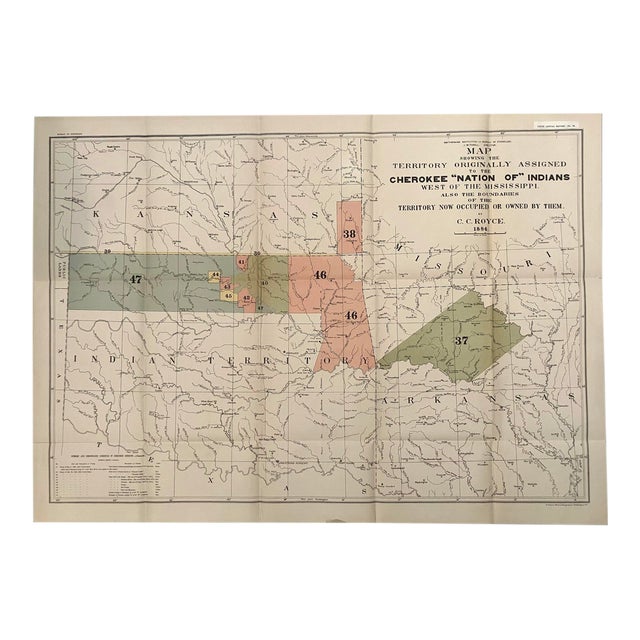
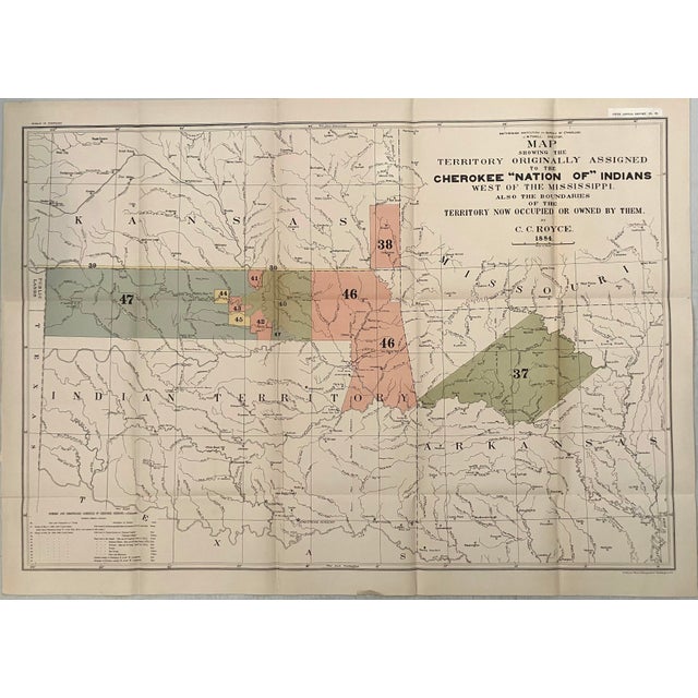
This interesting, large map shows lands owned and ceded by the Cherokee Indians by Royce in 1884. This large map … Read more This interesting, large map shows lands owned and ceded by the Cherokee Indians by Royce in 1884. This large map depicts, by coloring and numeric key, those lands owned and ceded by the Cherokee Indians. They are color-coded and numbered. The map shows the former territorial limits of the Cherokee Nation between the Ohio and Tennessee Rivers and the Appalachian Mountains. It depicts the various cessions made by them to the United States up to their removal to west of the Mississippi. It lists cessions numbered 37 through 47, and the Treaties of May 6, 1828 and July 19, 1866. The map also includes a small section of Public Lands, Kansas, and Arkansas, showing many villages, forts, and Indian Agencies. See less
- Dimensions
- 20.6ʺW × 0.1ʺD × 30ʺH
- Styles
- Traditional
- Frame Type
- Unframed
- Period
- Late 19th Century
- Country of Origin
- United States
- Item Type
- Vintage, Antique or Pre-owned
- Materials
- Paper
- Condition
- Good Condition, Original Condition Unaltered, Some Imperfections
- Color
- White
- Condition Notes
- Good. Slight toning. Colored. Issued folds. Good. Slight toning. Colored. Issued folds. less
Starting at 20% Off
Sale Ends November 23rd, 2026 - Shop Now
Questions about the item?
Returns & Cancellations
Return Policy - All sales are final 48 hours after delivery, unless otherwise specified in the description of the product.
Cancellation Policy - Prior to shipping or local pickup, buyers may cancel an order for up to 48 hours, unless otherwise specified.