

Details
Description
Rare 1729 copper engraved, hand-colored Chatelain miniature map of North America, full title "L'Amerique Septentrionale Suivant Mr. De L'Isle de …
Read more
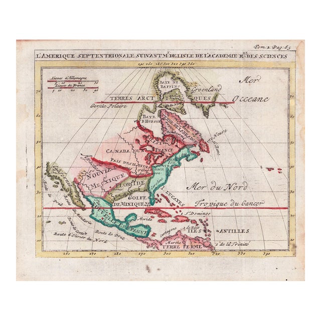
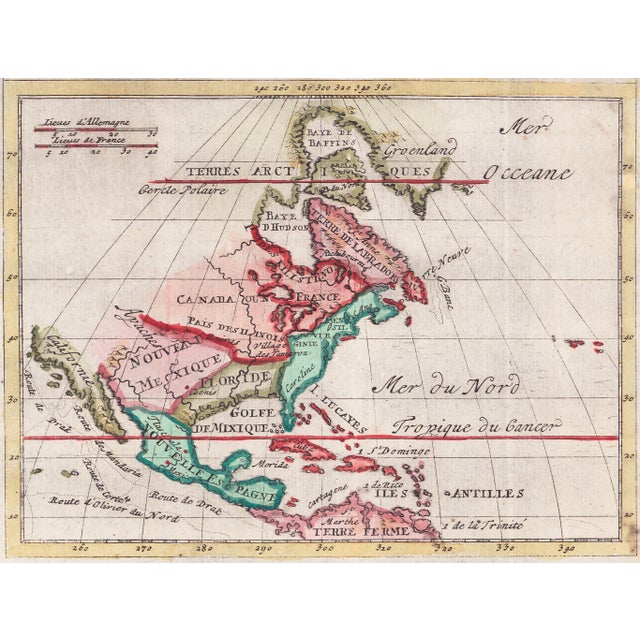
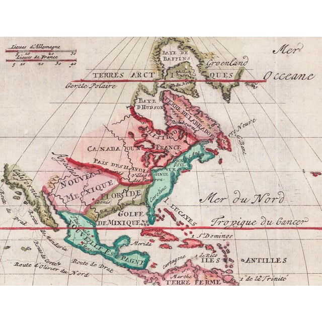
Rare 1729 copper engraved, hand-colored Chatelain miniature map of North America, full title "L'Amerique Septentrionale Suivant Mr. De L'Isle de l'Academie Re. des Sciences" (North America According to Mr. Guillaume Delisle of the Royal Academy of Sciences). The continent is partitioned into major colonial colonial territories of the era: Nouvelle Espagne (New Spain/Mexico); Nouveau Mexique & Floride (Spanish claims extending far inland); Canada ou Nouvelle France (French territories surrounding the Great Lakes); Terre de Labrador & Terres Arctiques (Northern British/Inuit lands).
Significantly, California is correctly represented as a peninsula (Californie) rather than an island, which was a cartographic debate at the time. The northwestern portion of the continent remains entirely unexplored and blank, labeled broadly under Arctic lands, demonstrating the limits of European geographic knowledge during the early 1700s. The map also traces historic maritime paths including the "Route de Drak" (Sir Francis Drake), "Route de Cortez", and "Route de Mandana".
Sheet size: 6-1/4 x 7-1/2 inches; map size: 5-1/4 x 6-3/4 inches. Printed on laid (chain paper). Three folds as issued. The map itself is in good condition, but the right edge has binding residue and there is also some scattered edge foxing.
Guillaume Delisle (1675–1726) was a prominent French cartographer and geographer widely regarded as the father of scientific cartography. He played a pivotal role in transforming map making from an artistic, speculative tradition into an empirical science based on rigorous mathematical precision and astronomical observations.
Zacharie Chatelain was a publisher and cartographer active in Amsterdam during the early 18th century, known for his work in producing the "Atlas Historique" alongside his son Henri Abraham Chatelain. He was part of a family partnership that contributed significantly to the field of map making and publishing during that time.
See less
- Dimensions
- 6.25ʺW × 0.1ʺD × 7.5ʺH
- Styles
- Realism
- Frame Type
- Unframed
- Period
- Early 18th Century
- Country of Origin
- France
- Item Type
- Vintage, Antique or Pre-owned
- Materials
- Paper
- Condition
- Good Condition, Original Condition Unaltered, Some Imperfections
- Color
- Magenta
- Condition Notes
- Three folds as issued. The map itself is in good condition, but the right edge has binding residue and there … moreThree folds as issued. The map itself is in good condition, but the right edge has binding residue and there is also some scattered edge foxing. Photographs are detailed and taken under controlled lighting; post-production is performed with calibrated monitors. Thus, our photographs accurately capture the work's condition and colors. However, monitors vary and can affect the way art appears online. Contact us for any concerns. less
Questions about the item?
Returns & Cancellations
Return Policy - All sales are final 48 hours after delivery, unless otherwise specified in the description of the product.
Cancellation Policy - Prior to shipping or local pickup, buyers may cancel an order for up to 48 hours, unless otherwise specified.